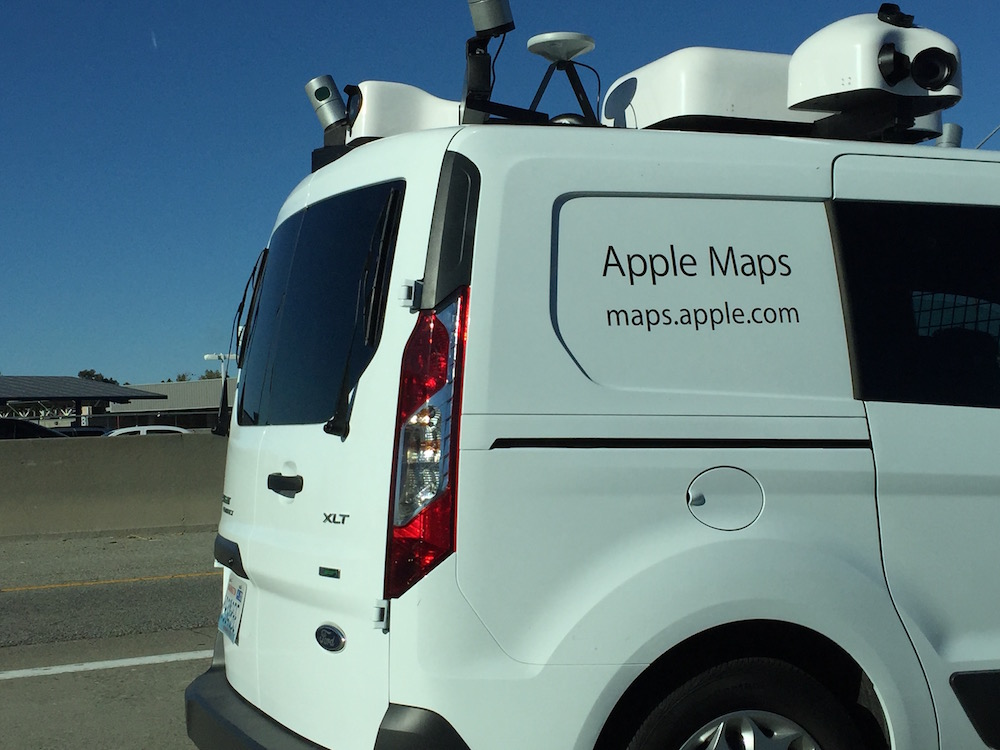
Recently, sightings of an Apple car can be seen all over the world, the car looks like it is equipped with a camera and GPS device on the top of the car, hinting that street view might be coming to Apple Maps. The car is just a simple white coloured vehicle with the words Apple Maps and website address on it.
 The cameras on the car are three wide-angle cameras with one in the centre and two more pointed at 45 degrees angles towards the street level and the centre camera is pointing up at the roofs with additional cameras at the front and back. What is even more interesting about this car is the Velodyne LIDAR sensors which are used in self-driving cars. These sensors have a 3D depth-sensing technology that bounces infrared light off objects giving the exact distance of the car in front and at the back giving you a true depth view of the area, something Google does not have.
With all this tech moving around on four wheels, this has the potential to make Apple Maps into a virtual 3D platform, it is already possible to use a VR headsets with the iMac so could this be just a matter of time before we will be able to walk around our streets using VR?
